


Key Takeaways
- Discover ten legendary climbs each with a unique blend of challenges and scenery.
- Essential gear and preparation can make these routes rewarding conquests.
- Expertise and insights can help tackle these iconic cycling ascents safely.
Ready to tackle some epic climbs?
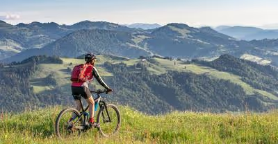
Mountain passes can offer the most rewarding experiences for cyclists.
As you pedal to the peak, you're not only challenging your endurance but also getting a front-row seat to some of the most stunning vistas on the planet.
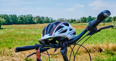
Strap on your helmet, because we're about to take you through ten climbs that are nothing short of legendary.
Each one tempts with its unique combination of breathtaking views and thigh-burning ascents.
These routes are more than mere roads; they're badges of honor for any serious cyclist.
You’re smart to do your homework before attempting these ascents.
We've got the scoop on the climbs that should be on your cycling bucket list.
With experience and insight into each pass, you’ll feel well-equipped to conquer these heights.
So clip in, it's going to be an exhilarating ride!
Trail Ridge Road (Colorado)

Have you ever pedaled to the sky?
On Trail Ridge Road in Colorado, you're pretty much doing just that.
This isn't just a road; it's a journey through the clouds, a feat for any cyclist!
Elevation: At 12,183 feet, your lungs will definitely feel the altitude as you conquer the highest continuous paved road in the United States.
Imagine cycling amongst the clouds — that's Trail Ridge Road for you!
Route Details:
- Length: 48 miles of pure adrenaline and awe-inspiring views.
- Starting Points: Either Estes Park or Grand Lake — pick your adventure!
- Scenery: Prepare your eyes for a feast. You'll be riding past majestic 12,000-foot peaks and expansive high-alpine tundra.
Why Ride Here?
- Views: A panoramic spectacle of the Rockies. Seriously, it's like an IMAX movie, but you're in it.
- Challenge: Those miles under your belt won't be easy, but they'll be rewarding.
- Wildlife: Ever seen an elk or a moose? Keep your eyes peeled!
Remember, the weather can be tricky up there, with fast changes and cooler temperatures — don't forget a jacket.
And since we're being responsible, sunscreen and water are your best pals on this ride.
In essence, Trail Ridge Road is more than just a stretch of asphalt — it's a bucket-list triumph for cyclists around the globe.
Your legs might scream, but your heart will sing with every pedal stroke.
Ready to conquer the sky?
Beartooth Highway (Montana/Wyoming)

Have you ever imagined cycling through the clouds, with breathtaking vistas unfolding before you?
If that's part of your cyclist's dream, the Beartooth Highway is calling your name.
Route Basics:
- Length: 68 miles
- Elevation: Peaks at 10,947 feet
- Location: Montana / Wyoming border
Imagine pushing your pedals along a path that snakes through the Montana skyline and dips into Wyoming's wild frontiers.
With elevations soaring nearly 11,000 feet above sea level, it's a place where nature's grandeur is on full display.
Why Ride Here?:
- Jaw-dropping views of the Beartooth Mountains
- Miles of rolling alpine plateaus
- Dramatic switchbacks to test your mettle
Your wheels will roll over the highest points in the northern Rockies, carving through switchbacks and climbing steep ascents.
Feel your heartbeat in your ears?
That's not just the workout – that's the thrill of Beartooth Highway!
Cycling Tips:
- Start from either Red Lodge or Cooke City
- Plan for weather changes at high elevations
- Allow time for stops to soak in the scenic views
Remember, with great heights come cooler temperatures and the potential for sudden weather shifts.
So, pack layers and be ready for anything Mother Nature tosses your way.
Are you up for the challenge?
Trust me, your cycling scrapbook will thank you for it!
Blue Ridge Parkway (North Carolina/Virginia)

Ever fancied pedaling through some of the most stunning landscapes the Appalachian Mountains have to offer?
Well, pack your gear, because the Blue Ridge Parkway awaits your wheels!
Spanning a whopping 469 miles, this isn't just a ride; it's an epic journey through Virginia and North Carolina.
So, what makes this Parkway a must-cycle for you?
Picture winding roads, a mosaic of lush forests and panoramic vistas at each turn—simply unforgettable!
Here's what you need to know:
- Distance: The parkway covers a distance of 469 miles, so you'll need to plan your ride.
- Views: With 200 overlooks, those rest stops are more than just breaks, they're photo ops.
- Climbs: Ready for a challenge? The route throws in climbs and descents that'll test your legs and reward you with views that stretch to eternity.
Remember, no matter how seasoned you are, tackling this in a single day is a no-go.
It’s not just about the destination; the beauty lies in the ride.
Your journey will have you cruise by the iconic Linn Cove Viaduct at Milepost 304, an engineering marvel just hooking off the mountainside!
Here's a quick tip: while you're out conquering peaks, the small mountain town of Galax, VA near Milepost 215, might just be the quaint retreat you need.
Alright, ready to make those two wheels hum on the pavement and feel the Appalachian breeze on your face?
The Blue Ridge Parkway isn’t just a cyclist's route; it’s a rolling bucket-list adventure.
Happy cycling!
Mount Evans Scenic Byway (Colorado)

Ever dreamed of cycling where the eagles soar?
That dream becomes real when you tackle the Mount Evans Scenic Byway in Colorado.
Called the road into the sky, Mount Evans is a cyclist's paradise and a pinnacle of biking achievements.
Starting from Idaho Springs, you’ll embark on a 28-mile route that's more than just a physical challenge; it's a journey through a spectrum of landscapes.
Aren’t you eager to find out what’s around each curve?
- Distance: 28 miles
- Elevation Gain: Over 7,000 feet
- Summit Altitude: 14,130 feet
- Open Season: Generally Memorial Day to Labor Day
Imagine pedaling through dense forests, across flowering meadows, to eventually face the raw beauty of the alpine tundra.
Here are a few tips to optimize your ride:
- Stay hydrated and well-nourished — the altitude can be a game-changer.
- Layer up! Temperatures can drop 3.5°F for each 1,000 feet of elevation gained.
- Check the weather — up there, conditions change in a heartbeat.
Did you know this route is the highest paved road in North America?
That's some serious bragging rights!
Now, let’s talk practicalities.
Since the weather is king, the byway is open when the snow clears, typically from Memorial Day to Labor Day.
Keep one thing in mind: the Mount Evans Scenic Byway isn’t just a test of endurance.
It’s a chance to connect with nature, and above all, it’s proof that the best views come after the hardest climbs.
Ready to saddle up and conquer these heights?
Going-to-the-Sun Road (Montana)

Ever imagined cycling where the horizon stretches infinitely, and every pedal gets you closer to the sky?
Let's talk about the incredible Going-to-the-Sun Road in Montana's Glacier National Park.
A challenge?
Yes.
Worth it?
Absolutely!
- Distance: 50 miles
- Elevation: Peaks at 6,646 feet at Logan Pass
On this historic road, you'll conquer more than just asphalt; you'll scale altitudes that can leave you breathless—in more ways than one.
Prepare to be dwarfed by the towering Rockies as you navigate a route that's a feast for the senses.
Why Cycle Here?
- Glacial vistas: Keep your camera ready!
- Alpine scenery: Meadows, wildlife, and waterfalls offer a natural spectacle.
- Historic value: This is a journey through the heart of nature and history.
Prep Checklist:
- Ensure your bike's up for the task—brakes checked?
- Pack layers; mountain weather can be a tease.
- Bring water and snacks. It's no stroll in the park.
- Check road status: Access varies with the whims of Montana's weather.
Imagine reaching Logan Pass, the crowning point of the route.
It's like touching the sky!
With every turn, the dramatic landscapes shift, showing off their rugged beauty.
It's not an easy ride, but oh, the stories you'll have to tell.
To pedal the Going-to-the-Sun Road is to embrace the raw spirit of Montana—where every climb leads to an awe-inspiring vista and every descent is a thrilling new chapter.
So, ready to gear up and make some memories at 6,646 feet?
Tioga Pass (California)

Have you ever experienced the thrill of cycling at nearly 10,000 feet?
If not, let me introduce you to Tioga Pass—the sky-scraping gem of California.
Nestled in the Eastern Sierra, Tioga Pass is not just a high point, it's the highest mountain pass you can conquer on a paved California highway.
Elevation: 9,945 feet
Route length: 39 miles through Yosemite National Park
Imagine this: You're pedaling up the scenic byway, and each turn offers a fresh, awe-inspiring tableau.
From vistas that stretch clear across the Sierra Nevada to the tranquil beauty of alpine meadows, the contrast of landscapes is as exhilarating as the ride itself.
- Why ride here? Stunning views, a chance to connect with nature, and a serious notch on your cyclist's belt.
- Prep talk: Bring your A-game and plenty of water because, at these heights, the crisp mountain air can be as challenging as the inclines.
Remember, Tioga Pass isn't just about the climb; it's a full sensory adventure.
Hear the rustle of the wind through Tuolumne Meadows, feel the sun's rays dance across mountaintops, and breathe in the scent of pine that says, "You've made it to high country."
Secure that helmet and test those brakes—you're about to embark on a ride that redefines 'peak' performance!
Just picture the sense of achievement waiting at the summit: it’s you conquering Tioga Pass, where the sky's the limit.
So, are you ready to ride among the clouds?
Haleakalā Crater Road (Hawaii)

Ever dreamed of cycling up a volcano to touch the sky?
Well, your biking bucket list begs for Haleakalā Crater Road on the island of Maui.
Imagine pedaling from the warm Hawaiian coast to an otherworldly landscape at over 10,000 feet!
Yes, that's right—from sea level to the summit of Haleakalā, you're in for a ride of 37 miles that's nothing short of epic.
Ready for some mind-blowing numbers?
This climb has a serious claim to fame—it's the #2 US and #30 World ranked bike climb.
And oh, the views!
As you ascend, the tropical scenery transforms dramatically to volcanic rock and stunning vistas of the crater.
Here's what you need to know:
- Starting Point: Sea level
- Elevation Gain: 10,023 feet
- Distance: 36 miles
- Rank: #2 in the US, #30 globally
The road tests your mettle with relentless gradients and two magnificent sets of hairpins before you even reach the park entrance.
Along the way, you'll break through the cloud line and, if it's a clear day, you'll be rewarded with a view so vast, you might spot the peaks of Mauna Kea!
Remember to prepare for the ever-changing conditions and altitude adjustment.
It’s not just about the climb; it’s about the journey.
Your dedication pays off with soul-stirring panoramic views.
Keep in mind, there's an entrance fee to the national park, so no surprises there.
But trust me, the acclaim is unanimous—biking Haleakalā Crater Road is a ride that etches into your memory forever.
Ready to conquer this crater?
Let’s get to it!
Independence Pass (Colorado)

Have you ever craved the thrill of cycling at lofty heights, where the sky is crystal clear and the mountain air is crisp?
Well, strap on your helmet, because Independence Pass in Colorado is calling your name!
This isn't your average bike route; we're talking about one of Colorado's highest, sitting at an elevation of 12,095 feet.
It's like being on top of the world!
This stunning pass covers a 32-mile route winding between Aspen and Twin Lakes, offering jaw-dropping views of the Sawatch Range.
Sure, the climb can test your mettle, but the rewards are unparalleled, with landscapes that are truly postcard-worthy.
Here’s a quick rundown of what you’re in for:
- Starting point: Aspen, Colorado
- Finish line: Twin Lakes, Colorado
- Distance: 32 miles
- Elevation gain: Peaking at 12,095 feet
The journey is not just about the destination—it's a continuous feast for the eyes with plenty of spots to take a breather and snap a few photos.
Expect a road that can be narrow and winding, so remember to stay safe on those tight switchbacks.
Whether you’re looking for a serious workout or a mesmerizing scenic cruise, Independence Pass delivers.
Each pedal brings you closer to the summit, where the Continental Divide greets you with open arms and possibly a high-five from Mother Nature herself.
Gear up, because this adventure is one you'll recount for years to come.
Ready to conquer Independence Pass?
Your bike is waiting!
Hurricane Ridge Road (Washington)

Have you ever imagined cycling up a road with views so stunning that they snatch your breath away—not from exertion, but pure awe?
That's exactly what you'll experience on Hurricane Ridge Road in Olympic National Park, Washington.
Starting just south of Port Angeles, this is where you’ll truly test your mettle!
The Ascent: The 17-mile stretch ascends to an impressive 5,242 feet, providing you with not just a workout but also staggering panoramas of the Olympic Mountains and the deep blue Strait of Juan de Fuca.
You’ll want to keep your camera handy for this ride!
- Grade Variations: The ride features gradients averaging 5% to 10%, with certain sections kicking up a notch. It’s a consistent challenge, with parts of the road hitting a 10% grade, ensuring that your legs will feel the burn.
- Steepest Sections: Prepare for the steepest quarter-mile boasting a 12.4% incline around mile 3.4, while your perseverance will be tested with a mile at 9% starting at 1.5 miles in.
Route Tips:
- Start Early: Hit the road early to savor the tranquility and avoid the afternoon crowds.
- Prepare Well: With few facilities on the route, ensure you're well-stocked on water and snacks.
- Weather Watch: The Pacific Northwest is known for its fickle weather, so pack layers and be prepared for changes.
Remember, the road to Hurricane Ridge is more than an exercise; it's an encounter with the sublime beauty of nature.
So go ahead, gear up, and let those wheels roll—you've got an unforgettable climb waiting for you.
And who knows?
The exhilarating descent might just be the cherry on top!
Palomar Mountain Road (California)

Have you ever craved an epic ride that tests both your legs and your spirit?
Look no further than the legendary Palomar Mountain Road in sunny California!
This isn't your average Sunday pedal; it's a true cyclist's challenge, boasting a 12-mile ascent that winds its way up to a breathtaking 5,285 feet.
Imagine this: you're pedaling through the Pauma Valley, the sun is on your back, and with each turn of the crank, you're rewarded with ever-more stunning views of the mountains and valleys that make Southern California a cyclist's paradise.
Why Palomar Mountain Road, you ask?
Well, let me paint you a picture:
- Challenge: The road is famous for its switchbacks, which are both a thrill and a test of endurance.
- Scenery: You'll be surrounded by nature’s splendor, making those grueling climbs totally worth it.
- Achievement: Reaching the summit gives you more than just bragging rights; it's a true sense of accomplishment.
Here’s a bit of what to expect:
- Start Line: Your journey begins in the Pauma Valley, where the climb gradually introduces itself.
- Elevation Gain: With every mile, the ascent cranks up, leading you to the summit.
Remember, this is a climb where slow and steady can win the race.
Keep your pace manageable, hydrate, and before you know it, you'll join the ranks of those who've conquered one of the most rewarding mountain passes in California.
So, are you ready to take on Palomar Mountain Road and add it to your list of cycling achievements?
Grab your bike, your buddies, and some sunscreen, and let the adventure begin!


.avif)
