


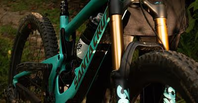
Key Takeaways
- Cycling routes in national forests offer diverse and stunning experiences.
- There are routes available for all cycling proficiency levels.
- These trips promise both challenge and rejuvenation.
Ever wished you could cycle through America's heartland?
Imagine pedaling under towering trees and across diverse landscapes in the tranquility of a national forest.
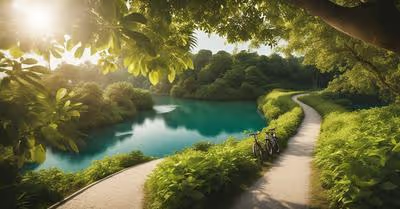
Cycling through the nation’s forests isn’t just about conquering challenging trails; it's about embracing the splendor of nature while on two wheels.
Nestled within these vast natural wonders are routes that promise an unforgettable adventure for cyclers of all levels.
Whether it's the picturesque climbs of mountain passes or the serene paths alongside burbling streams, these forests offer some of the most stunning cycling experiences in the country.
When planning your cycling trip through these national treasures, it’s reassuring to know that you’re getting the cream of the crop.
These routes have been forged by nature and time, maintained with care, and are beloved by cycling enthusiasts nationwide.
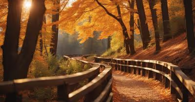
From majestic mountain loops to pastoral scenic byways, you're sure to find a route that not only challenges your stamina but also rejuvenates your spirit.
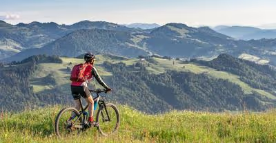
Trail Ridge Road, Rocky Mountain National Park (Colorado)

Have you ever dreamed of cycling at the very roof of America?
Well, buckle up for the ultimate ride, because Trail Ridge Road in Rocky Mountain National Park is your ticket to sky-high adventure!
- Starting Point: Near Estes Park
- Length: Approximately 48 miles
- Highest Elevation: 12,183 feet
Imagine pedaling through a realm where the air is crisp, and the panoramic views stretch for miles.
Yes, Trail Ridge Road isn't just any cycle route; it's the highest continuous paved road in the States!
Key Highlights:
- Breathtaking mountain vistas
- Possible sightings of majestic wildlife like elk and bighorn sheep
- Diverse ecological zones, from montane to alpine
Don't forget to pack your camera – this route is a goldmine of photographic glory.
And as you ascend, crossing giant switchbacks, you'll feel a rush unlike any other.
You're literally riding on top of the world, with over 20 miles of road below the summit towering at 12,000 feet.
But remember, at such great heights, the weather can be a bit of a wildcard – layers are your friends!
Also, the thin air up there isn't for the faint of heart, so take it easy and keep hydrated.
With every turn of the pedals, you’re carving through the heart of the Rockies, connecting Estes Park to Grand Lake.
This route is not just a journey; it’s a scenic byway that offers a 360-degree mountain experience.
So, ready to conquer Trail Ridge Road?
It's not just a ride; it’s an expedition that beckons the brave and rewards with sky-high splendor!
Going-to-the-Sun Road, Glacier National Park (Montana)

Ever dreamed of cycling through postcard-worthy landscapes?
Going-to-the-Sun Road in Glacier National Park might just be your dream come true.
How does pedaling across a 50-mile route punctuated with views of glaciers, pristine forests, and rugged peaks sound to you?
That's exactly what you get when you tackle this epic journey through Montana's wilderness.
First off, here's a fun fact: you'll be riding over the Continental Divide at Logan Pass, which sits proudly at an elevation of 6,466 feet.
Remember to pack a camera because trust me, you'll want to capture every moment of this stunning ride.
Here's what you need to know before you go:
- Best Time to Visit: Late June to early October. Keep in mind, our friend Mother Nature has a mind of her own here, dictating when the road is clear of snow.
- Length: A solid 50 miles. Whether you're looking for a challenging ride or a sweet day of sightseeing, this has you covered.
Your journey will be lined with views that are sure to make your heart skip a beat.
Imagine cycling alongside pristine valleys with alpine meadows blooming with wildflowers and tall mountains that scrape the sky.
Don't get too lost in the beauty though; keep those eyes on the road, too!
Make sure you're prepared for the changing weather conditions and carry enough water and snacks.
And here's another tip: audio tours are available to download, enhancing your experience with rich stories as you cycle through history and nature.
So, what do you say?
Are you ready to take on the Going-to-the-Sun Road?
Strap on that helmet, pump those tires, and get ready for an unforgettable adventure on two wheels!
Blue Ridge Parkway (Virginia and North Carolina)

Have you heard about the Blue Ridge Parkway?
It's like a rollercoaster through the clouds, but for your bike!
Snaking through Virginia and North Carolina, it's not just a road – it's 469 miles of pure cycling bliss.
Imagine pedaling up and down elevations from 649 to a breathtaking 6,053 feet!
Picture this: You're rolling along, and each turn gives you a postcard-worthy snapshot of the Appalachian Mountains.
Don't even get me started on the overlooks—they're the perfect spot to snap a selfie with the endless vistas.
It's not just lookouts, though; this parkway has history.
You'll roll past spots that tell the tale of these lands long before your two wheels hit the pavement.
Now, safety first, right?
Pop on a rear blinker and if you're tunnel-bound, fire up a high wattage headlight - it's a must.
This isn’t your average bike path; there're no specific bike lanes here, so stay sharp and enjoy the ride responsibly.
Here's what you should remember:
- Length: 469 miles
- Elevation Range: 649 – 6,053 feet
- Key Points: Overlooks, historic sites, access to national forests
- Precautions: No designated bike lanes, weather conditions vary, tunnels require lights
Whether you're after that serious leg burn or some zen moments in nature, biking the Blue Ridge Parkway is an experience you've got to put on your must-do list.
So what do you say, ready to conquer these storied mountain routes wheel by wheel?
Flaming Gorge-Uintas National Scenic Byway (Utah)

Have you ever wanted to spin through a landscape that shifts from desert sagebrush to alpine forests with the turn of your bike's wheels?
Well, let me introduce you to a place where such magic happens – the Flaming Gorge-Uintas National Scenic Byway in Utah.
This 80-mile stretch is a feast for the eyes and will keep your camera busy!
Imagine pedaling along the southern rim of the Flaming Gorge Reservoir, where the water's brilliant blue is juxtaposed against the rusty red canyon walls.
The route is nestled in the Ashley National Forest and gives you front-row seats to the grandeur of the Uinta Mountains.
-
Distance: 80 miles
-
Location: Starts from Vernal, Utah
-
Scenery: High desert, alpine forests, expansive reservoir views
-
Highlights:
-
Flaming Gorge Reservoir
-
Uinta Mountains
-
Ashley National Forest
It's not just about the ride; the wildlife here might just steal the show.
Keep your eyes peeled for deer and the occasional moose meandering nearby.
Encore performances by elk herds aren't uncommon, either!
And don't worry if you're not the Tour de France type; this route has plenty to offer regardless of your cycling prowess.
Fancy a quick stop?
There are spots along the way, like the Utah Field House of Natural History for a touch of education, or just pull over to soak in the views – trust me, they're worth it.
Remember to pack plenty of water and snacks, dress in layers (mountains can be fickle), and check your brakes – those descents can be a rush!
Happy cycling, and don't forget to wave at the local wildlife; they're part of the charm, after all!
Cascade Lakes Scenic Byway, Deschutes National Forest (Oregon)

Ever dreamed of pedaling through a postcard-worthy landscape?
On the Cascade Lakes Scenic Byway, that's exactly what you'll do!
This 66-mile masterpiece carves a path through the Deschutes National Forest in Oregon, offering views that'll make your heart rate spike even before you start pumping those pedals.
Heading out from Bend, the road quickly ascends toward Mt.
Bachelor, dotting your journey with a variety of Alpine lakes that gleam like sapphires among the pines.
Here's what your ride will look like:
- Century Drive: A historical route that's more than just a pretty path—it's a gateway to adventure in the rugged Cascades.
- Volcanic Vistas: Keep an eye out for Mt. Bachelor and Broken Top—they're hard to miss, and they're exquisite.
- Alpine Ponds Galore: Reflections of the sky await in the still waters of Devils Lake and Elk Lake, among others.
And speaking of lakes, you’re not just seeing double—there are them in abundance here!
Pack a picnic and take a break at the lakeside to truly absorb the sheer beauty of it all.
Remember, it's not a race; it's a journey.
Here are a few nuggets to keep in your back pocket:
- Altitude: Elevation increases quickly, so make sure your lungs are ready for a workout!
- Distance: At 66 miles, you're in for a decent day ride—hydrate, snack, repeat!
- The Ride: With no stops, it's a smooth cruise, but why rush? Natural beauty like this deserves your time.
Got your water bottles filled?
Good.
You're about to ride through one of the most enchanting stretches Oregon has to offer.
Pedal on, adventurer!
Cherohala Skyway (Tennessee and North Carolina)

Ever envisioned a bike ride that takes you a mile above sea level?
You've got to check out the Cherohala Skyway.
This isn't just any route; it's a beautifully paved ribbon that unrolls across the Cherokee and Nantahala National Forests, stretching between Tennessee and North Carolina.
- Distance: 43 miles
- Completion Year: 1996
- Cost: $100,000,000
Picture this: You're pedaling up and over 5,400-foot mountains with long, challenging climbs.
But don't worry—the breathtaking descents are the perfect reward for your efforts.
The Skyway isn't just about the workout; it's a feast for the eyes, with panoramic views that'll have you stopping just to soak it all in.
Let's break down this ride:
- In North Carolina: 18 miles of mountaintop roadway.
- En route to Tennessee: An additional 23 miles into pristine forests.
Along the way, spots like the Bald River Falls and the Joyce Kilmer Memorial Forest in Robbinsville, NC, beg for a visit.
Have your camera ready, because these are memories you'll want to hold onto.
Now, I bet you're thinking, "Where do I rest after all that cycling?" Well, there are cozy places aplenty near the Skyway.
Whether you're pitching a tent under the stars or checking into a charming B&B, you're covered.
So, are your legs ready for a bit of a workout?
Is your soul itching for some wilderness?
The Cherohala Skyway awaits to satisfy that wanderlust.
Pack your gear, grab a map, and let's cycle through the clouds!
Skyline Drive, Shenandoah National Park (Virginia)

Eager to spin your wheels amidst some breathtaking views?
Skyline Drive in Shenandoah National Park is calling your name!
This jewel of a route stretches 105 miles along the crest of the Blue Ridge Mountains, and trust me, it's a cyclist's dream.
Imagine cruising on two wheels, the fresh mountain air whooshing by, with nature's splendid artwork unfurling around each bend.
Did you know?
The drive boasts a leisurely speed limit of 35 mph, making it perfect for a ride that’s more about the journey than the destination.
Here's what you'll need to know:
- Length: 105 miles
- Speed limit: 35 mph
- Estimated Time: 3-4 hours by car; plan for a full day or an overnight bikepacking trip.
- Entrance Fee: $30 per vehicle, valid for 7 consecutive days.
Ready for an adventure?
Skyline Drive is not just asphalt and scenery:
- Overlays: Over 75 scenic overlooks to put those brakes to good use.
- Wild Encounters: Keep those eyes peeled for deer, black bears, and wild turkeys.
- Trail Access: Bike racks at trailheads invite you to hike a bit.
- Rides with a Twist: Start at Front Royal, Virginia, and prepare for a 4.5-mile climb right off the bat!
Remember to pack plenty of water, snacks, and maybe a camera—those views are too good not to share.
Whether you’re seeking a challenge or just a leisurely ride surrounded by nature's splendor, Skyline Drive is your ticket to an unforgettable experience.
Ready to pedal through paradise?
Great Allegheny Passage (Maryland and Pennsylvania)

Fancy a ride through lush forests and tranquil scenery?
Look no further than the Great Allegheny Passage, fondly known as the GAP Trail.
This jewel stretches 150 miles through Maryland's greenery and into the heart of Pennsylvania.
Let me paint you a picture: you're cycling between Cumberland, Maryland, and Pittsburgh, Pennsylvania, with nature's splendor as your company.
Isn't that a treat?
- Distance: 150 miles
- Elevation gain/loss: +1800 ft / -2300 ft
- Best season to ride: May to October.
- Difficulty level: Suitable for beginners to intermediate riders.
- Trail surface: Mostly gravel.
The trail effortlessly strings together the Allegheny Mountains, national forests, and historical waypoints into an unforgettable experience.
Imagine pedaling over bridges, through old railroad tunnels, and beside the tranquil waters of the Youghiogheny River.
No permits needed, just your bike and the call of the open trail.
Not only will you cross paths with fellow bike enthusiasts, but the smorgasbord of small towns dotting the route also offers cozy spots to rest and refuel.
And don’t forget about the medallions marking the endpoints; they're like little trophies heralding your arrival in Cumberland and Pittsburgh.
What's more satisfying than that?
Ready for some river views and a taste of history – all while getting a great workout?
Gear up and hit the GAP Trail.
Your adventure awaits!
Crater Lake Rim Drive, Crater Lake National Park (Oregon)

Have you ever pedaled around a volcanic caldera?
If not, the Crater Lake Rim Drive is your golden ticket.
With 33 miles of looping road, this journey offers unrivaled vistas of Crater Lake, known for being the deepest lake in the U.S. The lake's vibrant blue hue, set against a backdrop of lush forests, will make your cycling experience both breathtaking and serene.
Let's dig into what makes this route a must-ride:
- Scenic Overlooks: You're in for a treat with over 30 overlooks. They're ideal spots to snap a photo or simply soak in the views.
- Elevation changes: Ready for a workout? The road presents both climbs and descents that'll challenge your legs.
- Natural Wonders: Along the way, you’ll ride through forests and meadows, truly immersing you in the National Park's diverse ecosystem.
Remember to pace yourself; the route's steep sections can be tough but oh so rewarding.
And don't forget to bring water, snacks, and your best camera to capture the jaw-dropping scenery.
Curious when to go?
While the park is beautiful year-round, the best cycling conditions usually land between July and September, when the weather is the most accommodating and the road is free from winter's touch.
So, grab your bike, put on your helmet, and get ready to embark on an unforgettable cycling adventure along the Rim Drive.
Who knows, you might just find your new favorite route!
White Mountain Road, White Mountain National Forest (New Hampshire)

Have you ever felt the rush of wind on your face as you coast down a scenic road, flanked by towering mountains and lush forests?
That's exactly the thrill White Mountain Road in the White Mountain National Forest offers.
Biking this route isn't just exercise, it's an immersive nature experience!
Distance and Terrain: Prepare for a 34.5-mile journey that's just as rewarding as it is challenging.
You're riding on well-maintained roads, but keep in mind the varying elevations.
- Starting Point: Lincoln, NH
- Destination: Conway, NH
- Elevation Changes: Moderate to challenging, with some steep sections.
Imagine pedalling alongside rivers—you might even spot a few waterfalls spilling into crystal-clear pools.
Don't forget to take advantage of the scenic overlooks for that perfect photo op.
You'll want to remember these views!
What might you catch a glimpse of during your ride?
Well, with the dense forests of the White Mountains surrounding you, keep your eyes peeled for local wildlife.
And let's talk about those foliage seasons—a kaleidoscope of colors that turns the forest into an artist's palette.
Here's a tip: Make sure your bike is geared up for the ride.
Sections of the route can be tough, so you'll want reliable brakes and gears.
And pack plenty of water and snacks—you're going to need the energy.
Key Attractions Along the Route:
- Hiking trails offshoot from the road
- Scenic vistas worth every pedal-push
Before you set off, double-check the local conditions and any trail closures.
Safety first!
Ready to experience one of the best cycling routes in the national forests?
Strap on your helmet, and let's go!


.avif)
